Employment record
- Since 2005 University of Twente, Department of Water Engineering and Management.
- 2003-2004 WL |Delft Hydraulics (now Deltares), Marine and Coastal Management Division. Researcher/adviser (note: during the period Aug-Dec 2004 I was also employed at the University of Twente on part-time basis (20%), next to main employment at WL| Delft Hydraulics).
- 2000-2002 Leave due to maternity
- 1996-1999 Utrecht University, Department of Physical Geography. Assistant professor (1999) Postdoctoral position (1996-1998/99, variable appointments, 50%-100%)
- 1998-1999 Stationed at Twente University, Faculty of Technology and Management. Postdoctoral position (stationed on part-time basis (20%)).
- 1996-1998 Oregon State University, College of Oceanic and Atmospheric Sciences. Postdoctoral position (part-time, 50%)
- 1990-1995 Utrecht University, Department of Physical Geography. Junior scientist
Education
- PhD Geographical Sciences, Utrecht University, 1995
- MSc Physical Geography, Utrecht University, 1990
Expertise
Earth and Planetary Sciences
- Dune
- Transportation
- Earth Surface Sediment Transport
- Air Flow
- Morphology
- Accident Prevention
- Cellular Automata
- Foredune
Organisations
Research interests
Coastal morphodynamics, nature-based engineering, coastal observation and video remote sensing, the natural coastal system and its response to human intervention, anthropogenic shores.
Current research
AdaptCoast: Adaptive Coastal monitoring and modelling of intermittent anthropogenic and natural impacts on beach-dune systems (2024-2028)
Delta Enigma: Large-scale Research Infrastructure for Field Observation and Lab Experimentation to study bio-geomorphological processes in deltas (2023-2033)
SaltGarden: Sustainable Adaptive Landscapes through Transdisciplinary Gardening (2024-2028)
SOURCE: Sand nourishment strategies for sustainable Coastal Ecosystems (2024 -2030)
Biophysical controls on pollution flows in coral reef Marine Protected Areas (2023-2027)
Coastal vulnerability assessment for present and future (2023-2027)
From micro to macro scale: from sand grain behaviour to emergent coastal dune properties (2021-2025)
ReAShore: Resilient Anthropogenic Shores (2019-2024). Large scale sandy shore reinforcements like the Sand Motor and the Hondsbossche Dunes, combine flood safety and spatial quality. This project investigates how these functions can both flourish on the long term. To that end, the mutual influence is investigated of use and management of these man-created shores on the one hand, and natural processes like sand transport, vegetation dynamics and dune development on the other hand. Results are input for the
development of a design tool to co-create with stakeholders scenarios for use and management that optimally serve long term objectives of coastal safety and spatial quality
The Argus Program (ongoing): Video remote sensing of the beach and nearshore zone. The Argus program (http://cil-www.oce.orst.edu/), initiated at Oregon State University, aims at developing optical measurement approaches to exploit visible signatures of nearshore phenomena (hydrodynamics, morphology) with high resolution in space and time, using computer controlled video cameras. Video-stations are located at over 40 beaches around the globe. Data obtained are used to increase insight in the nearshore morphodynamic system. The Argus program is supported by an international research network of individuals and institutes who derive their funding from variable sources. Most recent project: Argus video imagery in support of aeolian transport studies (Nov 2011-May 2012). Exploratory study on mapping aeolian morphodynamics across an artificially created dune feature from Argus video imagery at Vlugtenburg beach (The Netherlands). Funded by ‘Ecoshape/Building with Nature’.
Past research projects (while at University of Twente)
ShoreScape: sustainable co-evolution of the natural and built environment along sandy shores. (2017-2023): The land-sea interface is a very attractive location for humans to settle. In the case of low lying, sedimentary coastlines this can be a risky location, as these shorelines are inherently dynamic in nature. Accelerating rates of relative sea level rise will increase coastal erosion, creating world-wide growing demands for coastal protection along urbanized shores. Central notion to this project is that the key to sustainably adapt to this situation is to be found in smart, pro-active sediment management using ‘building-with-nature’ approaches, rather than in traditional reactive approaches involving expansion of static, hard coastal defense structures. The ShoreScape project therefore aims to develop knowledge, tools and design principles for dynamic occupation of the land-sea interface, to enhance ‘building-with-nature’ processes and exploit its potential for the spatial development of multi-functional coastal environments – shorescape.
SEAWAD: Sediment supply at the Wadden Sea ebb-tidal Delta. From system knowledge to mega-nourishments (2016-2020): The Netherlands has chosen to protect its coast by means of soft adaptive solutions such as (mega) nourishments. As the Wadden Sea tidal basin is a net sediment importing system, several of its barrier island open coasts have to be nourished on a regular basis. This is exacerbated by the accelerated sea-level rise and subsidence and subsequently larger nourishment volumes are foreseen in the near future. One of the options considered is the possibility to put nourishments in the ebb-delta area, to more directly feed the tidal basins with sediment. However, the morphological and ecological impacts of such a large-scale intervention in a complex system as the ebb-tidal delta of the Wadden Sea are insufficiently known. This is all the more critical, as the anticipated mega-nourishments will be in the vicinity of the protected World Heritage area. Within SEAWAD, we develop the system knowledge and tools to predict the effects of mega-nourishments on morphology and ecology (benthos distribution). I am involved in the subproject Eco-dynamic design of nourishments as a co-supervisor of the PhD-research of Harriëtte Holzhauer in this topic. Funded by National Technology Foundation STW.
CoCoChannel:Co-designing Coasts using Natural Channel-shoal dynamics. (2014-2019): The CoCoChannel project aims at developing the knowledge and tools needed for innovative solutions to erosion problems along shorelines near tidal inlets; more specifically, Building-with-Nature type interventions such as triggering or stimulating shoal attachment through dredging or dumping of sediment at smart locations on the ebb-delta. Implementing such an innovative concept requires early interaction with stakeholders and coastal communities, not only to obtain their support but also to collaboratively improve the design of the intervention. Thus, the eventual design of these innovative interventions can be regarded as the product of a network of scientists, engineers and other stakeholders, and their social dynamics.
Aeolian and hydrodynamic sand exchange across the beach. (2013-2017): This project aims at understanding and modelling the sand exchange between the nearshore zone and the beach-dune system at a time scale of years to decades, on natural beaches. The exchange of sand between the nearshore zone and the beach-dune system occurs through both hydrodynamic and aeolian processes. Supply of sand from land to sea occurs mostly during storm surge erosion. Regarding the supply of sand from the sea to the land (accretion process), the intertidal beach is a crucial zone, because this is the area where sediments that are deposited by marine processes can be picked by wind to become part of the beach-dune system of the coast. The state of the intertidal beach is strongly tied to the nearshore morphodynamics, for instance through the development of ridge and runnel topography or rhythmic bars and beach topography. Knowledge development will focus on the accretionary component of the sand exchange. Argus video imagery of the intertidal beach collected at Egmond beach since 1998, are an important source of information for the analyses. Funded by: Conicyt (Comisión Nacional de Investigación Científica y Tecnológica). PhD involved: Leonardo Duarte Campos.
NatureCoast: Nature-driven nourishment of coastal systems. (2012-2017): In 2011 a huge shore nourishment (21 Mm3) has been applied at the Delfland coast (NL) in the shape of a peninsula (crtl-click here for some nice pictures). This unprecedented experiment aims to protect the hinterland from flooding by letting natural processes distribute sand over shoreface, beach and dunes, thus constituting a climate-robust and environmentally friendly way of coastal protection. The key objective of the NatureCoast program is to raise our understanding and predictive capability regarding the various aspects of this type of shore nourishments, up to a level enabling to assess their effectiveness and to export the underlying technology worldwide. The overall scientific challenge lies in understanding and predictive modelling of the complex interplay of eco-morphological, hydrological and societal processes that govern the evolution, effects, feasibility and acceptability of mega-nourishment (https://www.youtube.com/watch?v=7lzo1KDlqEU&feature=youtu.be). Hence this research program involves 12 research groups from different disciplines (program leader: Prof.dr.ir. M.J.F. Stive, TUD). I lead the Dune Formation subproject. This subproject aims at obtaining predictive understanding of both the impact of mega-nourishments on the spatio-temporal variability in aeolian sediment supply towards upper beach and dunes (PhD 1, at Univ. of Twente) and the key processes and conditions for making the transition from a bare beach to a vegetated dune, including associated landforms such as green beaches (PhD 2, at Wageningen UR). Funded by National Technology Foundation STW.
Congruent scales in economics, coastal engineering and morphology (2005-2011). ALW/LOICZ-funded project to explore whether congruent scales in economics, coastal engineering and morphology exist, and if so, how phenomena occurring at congruent scales might interact. PhD-student involved in the ‘coastal engineering and morphology’ topic: Lisette Bochev-van der Burgh. PhD-thesis successfully defended September 2012. Thesis title: Decadal-scale morphologic variability of foredunes subject to human interventions.
GIS-technology and the analysis and forecasting of change in the marine environment(2006-2010): research project within the framework of the BSIK-funded project We@Sea. PhD-student involved: Blanca Perez-Lapeña. PhD-thesis successfully defended April 2011. Thesis title: Detecting Seabird Displacement. A simulation based geostatistical approach.
Morphological development of the Banda Aceh Coast after the tsunami of December 26, 2004 (2004-2009). PhD-student involved: Ella Meilianda. (Note: I got involved in the project from October 2007 onwards). PhD-thesis successfully defended June 2009. Thesis title: Past, present and future morphological development of a tsunami affected coast. A case study of Banda Aceh.
Publications
2026
2025
Other contributions
Refereed scientific journals
- Gijsman, R., E.M. Horstman, D.van der Wal, D. A. Friess, A. Swales and K.M. Wijnberg (in press), Nature-based engineering: a review on reducing coastal flood risk with mangroves. Front. Mar. Sci. doi:10.3389/fmars.2021.702412.
- Poppema, D.W., Wijnberg, K.M., Mulder, J.P.M., Vos, S.E., Hulscher, S.J.M.H.,(2021). The effect of building geometry on the size of aeolian deposition patterns: scale model experiments at the beach, Coastal Engineering, https://doi.org/10.1016/j.coastaleng.2021.103866
- Mehvar, S., Wijnberg, K., Borsje, B., Kerle, N., Schraagen, J. M., Vinke-de Kruijf, J., Geurs, K., Hartmann, A., Hogeboom, R., and Hulscher, S. (2021) Review article: Towards resilient vital infrastructure systems – challenges, opportunities, and future research agenda, Nat. Hazards Earth Syst. Sci., 21, 1383–1407, https://doi.org/10.5194/nhess-21-1383-2021.
- Duarte-Campos, L., Wijnberg, K. M., & Hulscher, S. J. M. H. (2021). Field test of the accuracy of laser particle counters to measure aeolian sediment flux. Aeolian research, 50, [100676]. (https://doi.org/10.1016/j.aeolia.2021.100676)
- Holzhauer H., Borsje B.W., van Dalfsen J.A., Wijnberg K.M., Hulscher S.J.M.H., Herman P.M.J. (2020). Benthic Species Distribution Linked to Morphological Features of a Barred Coast. J. Mar. Sci. Eng., 8(1):16. (https://doi.org/10.3390/jmse8010016)
- Galiforni-Silva, F.; Wijnberg, K.M.; Hulscher, S.J.M.H.(2020). On the Relation between Beach-Dune Dynamics and Shoal Attachment Processes: A Case Study in Terschelling (NL). J. Mar. Sci. Eng. 8(7): 541. (https://doi.org/10.3390/jmse8070541)
- Galiforni-Silva, F., Wijnberg, K. M., & Hulscher, S. J. M. H. (2020). Storm-induced sediment supply to coastal dunes on sand flats. Earth Surface Dynamics, 8(2), 335-350. (https://doi.org/10.5194/esurf-8-335-2020)
- Galiforni Silva, F., K.M. Wijnberg, A.V. De Groot, S.J.H.M. Hulscher (2019). The effects of beach width variability on coastal dune development at decadal scales. Geomorphology, 329, 58-69. (doi.org/10.1016/j.geomorph.2018.12.012)
- Duarte-Campos, L. , K.M. Wijnberg, S.J.M.H. Hulscher (2018). Estimating Annual Onshore Aeolian Sand Supply from the Intertidal Beach Using an Aggregated-Scale Transport Formula. J. Mar. Sci. Eng., 6 (4): 127. (https://doi.org/10.3390/jmse6040127)
- Williams, I.A., K.M. Wijnberg, S.J.M.H. Hulscher(2018). Detection of aeolian transport in coastal images. Aeolian Research 35: 47-57, (doi.org/10.1016/j.aeolia.2018.09.003)
- Galiforni Silva, F., K.M. Wijnberg, A.V. De Groot, S.J.H.M. Hulscher (2018) The influence of groundwater depth on coastal dune development at sand flats close to inlets. Ocean Dynamics. (doi.org/10.1007/s10236-018-1162-8)
- Brouwer, T, D. Eilander, A. van Loenen, M.J. Booij, K.M. Wijnberg, J.S. Verkade, J. Wagemaker (2017). Probabilistic Flood Extent Estimates from Social Media Flood Observations. Natural Hazards and Earth System Sciences 17(5): 735-747.
- Duarte-Campos, L., Wijnberg, K.M., Oyarte-Gálvez, L., Hulscher, S.J.M.H., (2017). Laser particle counter validation for aeolian sand transport measurements using a high-speed camera, Aeolian Research 25: 37-44. (http://dx.doi.org/10.1016/j.aeolia.2017.02.002.)
- Van der Weerd, A.J., K.M. Wijnberg (2016). Aeolian sediment flux derived from a natural sand trap. J. of Coastal Research, Special Issue 75: 338-342.
- Pérez Lapenã, B., K.M. Wijnberg, A. Stein and S.J.M.H. Hulscher (2013). Spatial variogram estimation from temporally aggregated seabird count data. Environmental and Ecological Statistics, 20: 353–375. (doi: 10.1007/s10651-012-0223-2)
- Meilianda, E., B.H.P. Maathuis, and K.M. Wijnberg (subm). Geomorphological outline of Banda Aceh coast, Indonesia and the impact of the tsunami of 26 December 2004. Marine Geology.
- Bochev-van der Burgh, L.M., K.M. Wijnberg and S.J.M.H. Hulscher (accepted). Foredune management and foredune morphodynamics: A case study of the Netherlands' coast. Journal of Coastal Conservation.
- Pérez Lapenã, B., K.M. Wijnberg, A. Stein and S.J.M.H. Hulscher (2011). Spatial factors affecting statistical power in testing marine fauna displacement. Ecological Applications 21(7): 2756-2769. (doi: 10.1890/10-1887.1)
- http://www.esajournals.org/doi/abs/10.1890/10-1887.1
- Pérez Lapenã, B., K.M. Wijnberg, S.J.M.H. Hulscher and A. Stein (2011). Simulation-based impact assessment of offshore wind farms on seabirds. Journal of Sustainability Science and Management 6(1): 107-117.
- Bochev-van der Burgh L.M., K.M. Wijnberg and S.J.M.H. Hulscher (2011). Decadal-scale variability of managed coastal dunes. Coastal Engineering 58: 927-936.
- (doi:10.1016/j.coastaleng.2011.05.013 )
- Wijnberg, K.M., L.M. Bochev-van der Burgh, and S.J.M.H. Hulscher (2011). Coastal management and long-term foredune behavior: characterizing semi-natural foredune evolution. J. of Coastal Research, Special Issue 64, 329-333.
- Pérez Lapenã, B., K.M. Wijnberg, S.J.M.H. Hulscher and A. Stein (2010). Environmental impact assesment of offshore wind farms: a simulation-based approach. Journal of Applied Ecology 47: 1110–1118. (doi: 10.1111/j.1365-2664.2010.01850.x)
- Uunk, L., K.M. Wijnberg, and R. Morelissen (2010). Automated mapping of the intertidal beach from video images. Coastal Engineering 57: 461-469.
- (doi:10.1016/j.coastaleng.2009.12.002 )
- Horstman, E.M., K.M.Wijnberg, S.J.M.H.Hulscher, and A.J. Smale (2009). On the consequences of a long-term perspective for coastal management. Ocean and Coastal Management, 52: 593-611. (doi:10.1016/j.ocecoaman.2009.08.009)
- Bochev-van der Burgh L.M., K.M. Wijnberg and S.J.M.H. Hulscher (2009). Dune morphology along a nourished coastline. J. of Coastal Research, Special Issue 56: 292-296.
- Horstman, E.M. , K.M. Wijnberg, A.J. Smale and S.J.M.H. Hulscher (2009). Long-term coastal management strategies: useful or useless? J. of Coastal Research, Special Issue 56: 233-237
- Smit, M.W.J., Aarninkhof, S.G.J., Wijnberg, K.M., González, M., Kingston, K.S., Southgate, H.N., Ruessink, B.G., Holman, R.A., Siegle, E., Davidson, M. and Medina, R. (2007). The role of video imagery in predicting daily to monthly coastal evolution. Coastal Engineering 54: 539-553.
- Ruessink, B.G., K.M. Wijnberg, R.A. Holman, Y. Kuriyama, I.M.J. van Enckevort (2003). Intersite comparison of interannual nearshore bar behaviour. J. of Geophysical Research 108(C8): 3249-3260.
- Southgate, H.N., K.M. Wijnberg, M. Larson, M. Capobianco, and H. Jansen (2003). Analysis and modeling of field data on coastal morphological evolution over yearly and decadal time scales. Part 2: non-linear techniques. J. of Coastal Research 19 (4): 776-789.
- Larson, M., M. Capobianco, H. Jansen, G. Rozynski, H.N. Southgate, M. Stive, K.M. Wijnberg, and S. Hulscher (2003). Analysis and modeling of field data on coastal morphological evolution over yearly and decadal time scales. Part 1: background and linear techniques. J. of Coastal Research 19 (4): 760-775.
- Stive, M.J.F, S.G.J. Aarninkhof, L. Hamm, H. Hanson, M. Larson, K.M. Wijnberg, R.J. Nicholls and M. Capobianco (2002). Variability of shore and shoreline evolution. Coastal Engineering 47(2): 211-236.
- Wijnberg, K.M. Environmental controls on decadal morphologic behaviour of the Holland coast (2002). Marine Geology 189, 227-247.
- Wijnberg, K.M., and A. Kroon. Barred beaches (2002). Geomorphology 48: 103-120.
- Plant, N.G., B.G. Ruessink, and K.M. Wijnberg (2001). Morphologic properties derived from a simple cross-shore sediment transport model. J. of Geophysical Research 106(C1): 945-958.
- Van Rijn, L.C., and K.M. Wijnberg (1996). One-dimensional modelling of individual waves and wave-induced longshore currents in the surf zone. Coastal Engineering 28:121-145.
- Wijnberg, K.M., and J.H.J. Terwindt, (1995). Extracting decadal morphological behaviour from high-resolution, long-term bathymetric surveys along the Holland coast using eigenfunction analysis). Marine Geology 126: 301-330.
Conference proceeding
- Poppema, D. W., Wijnberg, K. M., Mulder, J. P. M., & Hulscher, S. J. M. H. (2019). Scale experiments on aeolian deposition and erosion patterns created by buildings on the beach. In P. Wang, J. D. Rosati, & M. Vallee (Eds.), Coastal Sediments 2019: Proceedings of the 9th International Conference (pp. 1693-1707). World Scientific. (doi.org/10.1142/9789811204487_0146)
- Wijnberg, K., Van der Spek, A., Galiforni Silva, F., Elias, E., Van der Wegen, M., and Slinger, J. (2017). Connecting subtidal and subaerial sand transport pathways in the Texel Inlet system. Proceedings Coastal Dynamics 2017, 12-16 June 2017, Helsingør, Denmark, 10 pp.
- Galiforni Silva, F, Wijnberg K.M., De Groot A.V., and Hulscher, S.J.M.H. (2017). On the Importance of tidal inlet processes for coastal dune development. Proceedings Coastal Dynamics 2017, 12-16 June 2017, Helsingør, Denmark, 10p.
- Wijnberg, K., Mulder, J., Slinger, J., Van der Wegen, M., Van der Spek, A. (2015). Challenges in developing ‘Building with Nature’ solutions near tidal inlets. Proceedings Coastal Sediments 2015, 11-14 May 2015, San Diego, USA, 13p.
- Van der Weerd, L., Wijnberg, K. (2015). Aeolian activity on a peninsula-shaped mega nourishment. Proceedings Coastal Sediments 2015, 11-14 May 2015, San Diego, USA, 12p.
- Wijnberg, K.M., Van der Weerd, A.J., Hulscher, S.J.M.H. (2014). Tracking Aeolian transport patterns across a mega-nourishment using video-imagery. Geophysical Research Abstracts, Vol. 16, EGU2014-9187, EGU General Assembly 2014, Vienna, Austria, 1 p.
- Schretlen, J.L.M. and Wijnberg, K.M. (2013). Argus video imagery in support of aeolian transport studies. (p. 526). Plymouth: University of Plymouth, 12th International Coastal Symposium ICS2013, 8-12 April 2013, Plymouth, United Kingdom.
- Hoonhout, BM, Vries, S de, Baart, F, Thiel De Vries, JSM van, Weerd, L van der & Wijnberg, K (2013). Monitoring of beach surface properties with remote sensing. In: P Bonneton & T Garlan (Eds.), Proceedings Coastal Dynamics 2013, 7th International conference on coastal dynamics, Bordeaux, France: pp. 821-832.
- Weerd, A.J., Wijnberg, K.M., Werf, J.J., Walstra, D.J.W. & Ribberink, J.S. (2013). Wave-driven dynamics of shoreward propagating accretionary waves. (p. 27). RCEM2013, University of Cantabria, Cantabria, Spain.
- De Groot, A.V., De Vries, S., Keijsers, J.G.S., Riksen, M.J.P.M,. Ye van, Q., Poortinga, A., Arens, S.M., Bochev-Van der Burgh, L.M., Wijnberg, K.M., Schretlen, J.L. , Van Thiel de Vries, J.S.M. (2012). Measuring and modeling coastal dune development in the Netherlands. In: Kranenburg, W.M. , Horstman, E.M. and Wijnberg, K.M., (eds.) NCK-days 2012 : Crossing borders in coastal research : jubilee conference proceedings, University of Twente, Department of Water Engineering & Management, Enschede, the Netherlands, ISBN 9789036533423.: p.105 –110. (DOI: 10.3990/2.178)
- Pérez Lapeña, B., and Wijnberg, K.M., (2012). Statistical power in testing seabird displacement due to an offshore wind farm: a case study off the coast of Rhode Island. Book of Abstracts NAOC 2012 – From sea to sky, Vancouver, Canada, p. 269. (invited contribution)
- Pérez Lapeña, B., Wijnberg, K.M., Stein, A., Hulscher, S.J.M.H. (2011). Statistical power in testing marine fauna displacement due to an offshore wind farm. In: R.May and K. Bevanger (eds.), Proceedings Conference on Wind energy and Wildlife impacts, 2-5 May 2011, Trondheim, Norway, NINA Report 693: p. 46.
- Wijnberg,K.M., and L.M. Bochev-van der Burgh (2010). Impact of coastal management practice on long-term foredune behaviour. Geophysical Research Abstracts, Vol. 12, EGU2010-7216-2, 2010, EGU General Assembly 2010, Vienna, Austria, 1 p.
- De Oude, R., D.C.M. Augustijn, K.M. Wijnberg, F. Dekker, M.B. de Vries, T. Suzuki (2010), Bioengineering in front of a river dike: wave attenuation by vegetation. In: G.C. Christodoulou and A.I. Stamou (eds.) Environmental Hydraulics. Proceedings of The 6th International Symposium on Environmental Hydraulics, Athens, Greece, 23–25 June 2010. Volume 1, p. 253-258. Taylor & Francis Group, London, ISBN 978-0-415-58475-3
- Wijnberg, K.M., L. Uunk, R. Morelissen, A.B. Cohen, and S. J.M.H. Hulscher (2009). Beach response derived from automated bathymetry measurements. In: J. McKee Smith (ed), Coastal Engineering 2008, Proc. of 31st Int. Conf. on Coastal Engineering, Hamburg, Germany: p. 2363-2372.
- Pérez Lapeña, B., K. Wijnberg, S.J.M.H. Hulscher, J. de Leeuw (2008). Impacts of offshore wind farms on seabirds, dealing with spatio-temporal variability. Book of abstracts of the International Statistical Ecology Conference, 9–11 July 2008, St. Andrews (Scotland), 1p.
- Wijnberg, K.M., and Holman, R.A., (2007). Video-observations of shoreward propagating accretionary waves. Proc. RCEM2007, Enschede, The Netherlands: 737-743.
- Van der Burgh, L.M., K.M.Wijnberg, S.J.M.H. Hulscher, J.P.M. Mulder, M.van Koningsveld (2007). Linking coastal evolution and super storm dune erosion forecasts. Proc. Coastal Sediments ‘07, New Orleans, USA:1813-1826.
- Wijnberg, K.M., Aarninkhof, S.G.J., Spanhoff, R., (2007). Response of a shoreline sand wave to beach nourishment. Proc. Of 30th Int. Conf. on Coastal Engineering 2006, San Diego, USA: 4205-4217.
- Aarninkhof, S., Wijnberg, K., Roelvink, D., Reniers, A. (2005). 2DH-Quantification of surf zone bathymetry from video. Proc. Coastal Dynamics ’05, Barcelona, Spain.
- Wijnberg, K.M., Aarninkhof, S.G.J., Van Koningsveld, M., Ruessink, B.G. and Stive, M.J.F. (2004). Video monitoring in support of coastal management. Proc. Of 29th Int. Conf. on Coastal Engineering, Lisbon , Portugal: 3136-3148.
- Ruessink, B.G., R.A. Holman and K.M. Wijnberg (2001). Interannual nearshore bar behaviour: An intersite comparison. Proc. Coastal Dynamics ’01, Lund, Sweden. 646-655.
- Van Enckevort, I.M.J., and K.M. Wijnberg (1999). Intra-annual changes in bar plan shape in a triple bar system. Proc. Coastal Sediments ’99: 2548-2558.
- Aarninkhof, S.G.J., C.L. Hinton and K.M. Wijnberg (1998). On the predictability of breaker bar behaviour. Proc. 26th Int. Conf. on Coastal Engineering, Copenhagen, Denmark: 2409-2422.
- Wijnberg, K.M., and R.A. Holman (1997). Cyclic bar behaviour viewed by video imagery. Proc. Coastal Dynamics ’97, Plymouth, UK: 375-384.
- Wijnberg, K.M. (1996). On the Systematic decay of breaker bars. Proc. 25th Int. Conf. on Coastal Engineering: 3600-3613.
- Wijnberg, K.M., and L.C. van Rijn (1995). One-dimensional modelling of individual breaking waves. Proc. Coastal Dynamics ’95, Gdansk, Poland: 341-354.
- Wijnberg, K.M., and F.C.J. Wolf (1994). Three-dimensional behaviour of a multiple bar system. Proc. of Coastal Dynamics ’94: 59-73.
- Wijnberg, K.M., and J.H.J. Terwindt (1993). The analysis of coastal profiles for large-scale coastal behaviour. in: J.H. List (ed): Proceedings of Large Scale Coastal Behaviour ’93, US Geological Survey Open-File Report 93-381: 224-227.
- Terwindt, J.H.J, and Wijnberg, K.M. (1991). Thoughts on large-scale coastal behaviour. Proc. Of Coastal Sediments ’91:1476-1487.
Professional publications
- Horstman, E.M., A.J.P. Helder, and K.M. Wijnberg (2008). Lange termijnvisie kustbeheer vraagt grotere ruimteschalen. Land+Water, 48 (11): 24-25.
Books or contribution to books
- van Bergen, J., Mulder, J., Nijhuis, S., Poppema, D. W., Wijnberg, K. M., & Kuschnerus, M. (2021). Urban dunes: Towards BwN design principles for dune formation along urbanized shores. In J. van Bergen, S. Nijhuis, N. Brand, & M. Hertogh (Eds.), Building with Nature perspectives: Cross-disciplinary BwN approaches in coastal regions (pp. 101-128). (Research in Urbanism Series; Vol. 7). TU Delft open. https://doi.org/10.47982/rius.7.130.
- Wijnberg, K., Poppema, D., Mulder, J., van Bergen, J., Campmans, G., Galiforni-Silva, F., Hulscher, S., & Pourteimouri, P. (2021). Beach-dune modelling in support of Building with Nature for an integrated spatial design of urbanized sandy shores. Research in Urbanism Series, 7, 241-260. https://doi.org/10.47982/rius.7.136
- Mulder, J., Galiforni-Silva, F., d'Hont, F., Wijnberg, K.M., van der Spek, A., van der Wegen, M., & Slinger, J. H. (2020). Texel inlet dynamics and shoreline management. In J. Slinger, S. Taljaard, & F. d'Hont (Eds.), Complex coastal systems : Transdisciplinary learning on international case studies (pp. 31-46). Delft Academic Press.
- Kranenburg, W.M., Horstman, E.M. and Wijnberg, K.M., (Eds.) (2012) NCK-days 2012 : Crossing borders in coastal research : jubilee conference proceedings. University of Twente, Department of Water Engineering & Management, Enschede, the Netherlands. DOI: 10.3990/2.165
- Filatova, T., L.M. Bochev-van der Burgh, K.M. Wijnberg, S.J.M.H. Hulscher, A. van der Veen, J.P.M. Mulder (2011). Congruent scales in economics, coastal engineering and morphology. In: C. Heip and R. Laane (Eds). Aspects of coastal research in contribution to LOICZ in the Netherlands and Flanders (2002-2010). LOICZ Research and Studies No. 38, Helmholtz-Zentrum Geesthacht: 129-137.
- Wijnberg, K.M. (1998). Large-scale decadal behaviour of nearshore morphology: three case studies of multiple barred coasts. In: A. Kroon and B.G. Ruessink (Eds.), Geographical Development in Coastal Morphodynamics, Utrecht University, The Netherlands: 185-203.
- Wijnberg, K.M. (1995). Morphologic behaviour of a barred coast over a period of decades. PhD-thesis Utrecht University, Netherlands Geographical Studies 195, K.N.A.G., Utrecht, The Netherlands, 245 pp.
Reports
- Schretlen, J.L.M., and Wijnberg, K.M., (2012). Argus video imagery in support of aeolian transport studies: an exploratory study at Vlugtenburg beach. Report Ecoshape/Building with Nature, workpackage HK 3.2, 61 pp.Reports
- Asjes, J., R. Hille Ris Lambers, T. Reijs, J.T. van der Wal, S. van Heteren, K. Wijnberg, B. Pérez Lapeña, (2010). Spatial management, ecological impacts and monitoring in relation to offshore wind energy development on the Dutch Continental Shelf. A review of the results of We@Sea Research Line 2: Spatial Planning and Environmental Aspects. Report number C140/10, We@sea/ IMARES-WUR, 110 pp.
- Pérez Lapeña, B., and Wijnberg K.M., (2010). Analysis and forecasting of change in the marine environment: a method for identifying impact of large scale offshore wind farms on marine fauna. Report We@sea / Research line 2, 49 pp.
- Wijnberg, K.M., Roelvink, J.A., Aarninkhof, S.G.J. (2004). Bed variability in the surf zone at the storm- and seasonal time scale, mapped by Argus-video techniques.WL|DelftHydraulics, Report – Z3781b, 28 pp.
- Wijnberg, K.M. (2004). Bruikbaarheid voor de kustbeheerder van door Argus gemeten beheersparameters. Nauwkeurigheid, inzetbaarheid en toegevoegde waarde. WL|DelftHydraulics, Report-Z3781a, 54 pp.
- Wijnberg K.M., and Verhage, L. (2004). Strandbreedte ontwikkeling nabij Egmond 1999-2004. WL|DelftHydraulics, Report – Z3828, 9 pp.
- Wijnberg, K.M., and Aarninkhof, S.G.J. (2003). Monthly evolution of a nourished barred beach. WL|DelftHydraulics, Report – Z3290, 49 pp.
- Roelvink, J.A., Aarninkhof, S.G.J., Wijnberg, K.M., Reniers, A.J.H.M. (2003). Quantification of 2D subtidal bathymetry from video. WL|DelftHydraulics, Report – Z3536, 19 pp + Appendices.
- Wijnberg, K.M., Ruessink, B.G., Stive, M.J.F., Van der Spek, A.J.F., Walstra, D.J.R., (Eds.), (2003). Delft Cluster – Coasts, Final Report. Report DC-03.01.003-02 / WL|Delft Hydraulics Z2822: 117 pp.
- Wijnberg, K.M., and Kroon, A. (1999). Wave–formed nearshore bars. A review of bar morphodynamics in the intertidal and subtidal domain. Institute for Marine and Atmospheric Research Utrecht (IMAU), Utrecht University, The Netherlands, report R 99-07, 46 pp.
Research profiles
- Assessing the hydraulic conductivity of the seepage-reducing measure ’Sand Bentonite’ in diverse environments - Joep Witteman (2024)
- Flow-vegetation feedback of emergent and submerged rigid vegetation in staggered formations - Thom Keijzer (2024)
- The role of herbaceous plant root characteristics on hydraulic stream bank erosion. A case study for the riparian zone of the river Dinkel. - Floris Couwenberg (2024)
- Flow-vegetation interactions at the vegetated river banks of the River Dinkel - Bram Denkers (2023)
- Beach pavilion on adjustable pole height: A numerical study of flow and sediment transport towards coastal dunes - Nino Zuiderwijk (at Witteveen & Bos, 2023)
- Reliability analysis of piping assessment: assessing the influence of spatial variation of subsoil parameters - Lutsen Bonekamp (at BZ Innovatie Management, 2022)
- Seasonal variation in salt marsh vegetation. Impact of physical stressors on the development, decay and seed retention of Salicornia Europaea - Bert Eekman (2021)
- Predicting flooding due to extreme precipitation in an urban environment using machine learning algorithms - Raphael Kilsdonk (at Hydrologic, 2021)
- Mangrove dynamics in the Richmond River's estuary - Steven Hoogeveen (2020)
- Feasibility assessment of a grass cover dike in a coastal wetland setting. Towards a green design tool - Marc Horstman (at RHDHV, 2020)
- Pressure propagation through the bed in the swash zone of a sandy beach. A data and modelling study with possible implications for sediment transport - Tim Pauli (2020)
- Observing ocean currents on the scottish continental shelf using wave gliders.- Siska de Vreeze (at Marine Scotland Science, 2020)
- Quantifying physical stressors controlling mangrove seedling dynamics - Marijn Gelderland (2020)
- Quantification of uncertainties in slope stability assessment and strategies to reduce the uncertainty - Luuk Vonk (at BZ Innovatie mangement, 2020)
- The impact of aeolian sedeiment transport on vegetation development in engineered coastal dunes and dune valleys - Job Oude vrielink (at Delatres, 2020)
- Impact of ship waves on sediment transport at two tidal flats in the Western Scheldt - Marco Aldershof (at Deltares, 2020)
- Pocess-based support for supply limitations on the aeolian erosion prohability from AeoLIS to DUBEVEG - Andrea Flores Ramirez (at Deltares, 2020)
- Numerical modelling of the biophysical feedbacks of Salicornia at the constructed Marconi salt marsh - Jesse van de broek (2020)
- Predictive analytical model for chloride concentrations in the Port of Rotterdam – Ralf Linneman (Hydrologic, 2019)
- Long-term effects of intensified desalination and climate change on nearshore salinity in the Arabian Gulf – Felix Dols (at Deltares, 2019).
- The applicability of the cellular automata model DUBEVEG on an anthropogenic shore - Jan Willem van Dokkum (2019)
- Construction variants for the Sandbar breakwater in a dynamic coastal area. - William Wilbrink (at CDInternational , 2019)
- Quantification and reduction of uncertainties in the piping assessment: a comparison of uncertainty reducing strategies. - Sean Roelofs (at BZ Innovatie Management, 2018)
- Hydrodynamics and sand transport on the lower shoreface of the Ameland tidal inlet. Max Leummens (at Deltares, 2018)
- Analysing pre- and post-nourishment morphologic behaviour along the Dutch-Danish North Sea coast. - David Barmentloo (at Rijkswaterstaat, 2018).
- Flood safety: What is an acceptable level of uncertainty in the safety assessment of piping ? - Jasper Bink (at BZ Innovatie Management, 2017).
- Non-hydrostatic pressure around scour holes in sharp bends - Rik Posthumus (2017).
- What do stakeholders have to say about sand nourishments? The use of uncertainties to cope with gaps in water governance in the context of Dutch adaptation to climate change.- Rafael Imada (2017).
- The effects of storm surges on dune-systems near inlets - Stan van den Broek (2017).
- Understanding the effect of groynes on the hydrodynamics of the tidal flats in estuaries. A case study at Baalhoek and Knuitershoek in the Western Scheldt – Tim van den Broek (at Deltares, 2017 ).
- A statistical approach towards the response of dune systems to tidal inlet processes – Bert Dekker (2017).
- Can state-of-the-art numerical modeling be used to design more efficient and economic power plants? – Annet Both (at Deltares, 2016)
- Numerical modelling of morphological development in a managed realignment project. A case study of the Eastern Perkpolder project, The Netherlands – Xinyue Zhao (at Deltares, 2016)
- Real-time flood extent estimates from Twitter messages: mapping uncertainties – Tom Brouwer (at Deltares, 2016)
- Effects of beach holiday houses on the wind and related sand transport – Elise Leusink (2016)
- Mental models of dune dynamics and perspectives for regulating construction of beach huts – Ethan Tromp (2016).
- Influence of data and information in the assessment of the piping failure mechanism – Julius van Stokkum (at BZ Innovatiemanagement, 2016)
- Operational early warning system in MorphAn – Jelmer Veenstra (at Deltares, 2016)
- Modelling sediment transport pathways in the mouth of the Scheldt estuary – Stefan de Vries (at Deltares, 2016).
- Arctic precipitation changes and their effect on the Atlantic Meridional Overturning Cycle (AMOC) – Niek Sleen (at KNMI, 2015).
- Including the effect of buildings in the probabilistic modelling of dune safety – Thijs Raaben (at Deltares, 2015).
- Aeolian transport on beaches, on the role of transport limiting factors – Elisa Reim (2013)
- Predicting storm impact on coastal dunes at Ameland – Auke Terlouw (at Deltares, 2013)
- Wave-driven dynamics of Shoreward Propagating Accretionary Waves in the nearshore – Lianne van der weerd (at Deltares, 2012)
- Safety assessment of coastal dunes as flood protection – Peter Brandenburg (at Deltares, 2010)
- Modeling of wave attenuation by vegetation in SWAN to be applied in the design of a vegetation-fronted dike in the Noordwaard – einout de Oude (at Deltares, 2010).
- A comparison of applied wave-dominated sand transport models including boundary layer streaming – Willem Wong (2010).
- Improved long-term coastal management as a result of a large-scale spatial perspective - Erik Horstman (at Witteveen+Bos, 2008).
- Salt intrusion in the Selangor Estuary in Malaysia - Maarten van Breemen (at Alkyon, 2008).
- Automated collection of intertidal beach bathymetries from Argus video images - Laura Uunk (at WL|Delft Hydraulics, 2008).
- Coastal morphodynamics at Egmond beach (The Netherlands) – Elmi van den Braak, Lisette Grolle, Cynthia Reintjes, Michelle Berg (1999).
- Managed realignment at Tollesbury (UK) – Sandra Vermeer (at Cambridge University, UK, 1998).
BSc final projects
- Exploring the potential of XBeach in relation to erosion tests in the GWK flume of a new dike design including an erodible layer (at Forschungszentrum Küste, Germany, 2017) - Geert Luijkx.
- Rioolmodellering Rotselaar (at Antea Group, Belgium, 2016) - Daniël van Dijk.
- Golfoverslag in bebouwd gebied (at TAUW, 2016) - Annemarie van Os.
- De kust – meer dan hoogwaterbescherming; Een verkenning van de baten van kustlijnzorg. (at HKV, 2015) – Tessa Andringa,
- Geuroverlast riolering in Nederland (at Arcadis, 2015) - Marien Korevaar.
- Verkenning uitvoeringsstrategieën voor afkoppeling hemelwaterafvoer in Enschede (at Gemeente Enschede, 2015) - Robert Hofstra.
- Invloed klimaatverandering op grondwaterstand in stedelijk gebied (at Wareco Ingenieurs, Deventer, 2014) – Maarten Baan. (Influence of climate change on groundwater levels in urban areas)
- Meetmethodiek eolisch zandtransport: het meten van overstuiving over de zeereep. (at Witteveen + Bos, Rotterdam, 2014) - Tom Maatkamp. (Methodology for measuring aeolian sand transport: measuring sand pray passing the foredune)
- Knelpunten analyse voor het rioleringsstelsel van Kontich (at Antea Group Gent, Belgium, 2013) - Rigt Venema.
- The effect of pontoons on flow patterns in small harbors (at University of Aberdeen, UK, 2013) - Leonie Straatsma
- Een studie naar de standaardisatie van gemalen (at TAUW, 2013) - Rens Holterman
- Sediment load assessment and sediment management in the Broadlands Hydropower Project in the upper reaches of the Kelani River (at Ceylon Electricity Board, Dharmapala, Sri Lanka, 2012) – Eric Jacobs.
- Analysis of the water availability for the area of Einlanden-Digul-Bikuma (at PusAir Center for Water Resources, Bandung, Indonesia, 2012) - Bouke Pieter Ottow
- From camera to GIS: A feasibility study for camera-based automatic inspection of river banks (at Grontmij, De Bilt, 2011) - Matthijs Bary.
- River bed changes of the River Overijsselse Vecht (at Waterschap Groot Salland, Zwolle, 2011) - Renier Kramer.
- Sedimentation problems in the Cilalawi River, Indonesia (at Padjadjaran University, Bandung, Indonesia; 2011) - Gerben Jan Vos.
- Van weiland tot woonwijk (at Aveco de Bondt, 2011) – Herman Brink (From pasture land to residential area).
- Dijkversterking Noord-Groningen (at waterschap Noorderzijlvest, 2011) – Thijs Visser (Dike reinforcement in Noord-Groningen, The Netherlands).
- Historical hurricane atlas (at Royal Haskoning, New Orleans, USA, 2010) - Rinse Joustra.
- Sediment source assessment in the Gippsland Lakes (at Department of Primary Industries, Rutherglen, Victoria, Autralia, 2010) - Lianne van der Weerd.
- Experimental Surge forecasting tool eSURF (at Royal Haskoning, New Orleans, USA, 2009) – ChuHui Lin.
- A predictive model for hurricane surge levels in New Orleans (at Royal Haskoning, New Orleans, USA, 2008) - Marcel van den Berg.
- Onderzoek naar de relatie tussen drinkwaterverbruik en weerscondities (at DHV, Amersfoort, 2007) - Lea Goedhart (Relation between weather conditions and the consumption of drinking-water).
- Onderzoek naar de verwachtingen van actoren m.b.t. de voorbereiding van vaargeulverdieping Hanzerak-West (at Rijkswaterstaat – directie IJsselmeer gebied, 2007) – Suleyman Naqshband. (Stakeholder expectations in the preparation-phase of the deepening of the Hanzerak-West waterway).
- Invloed onverzadigde zone op een bestaand “quickscan”-model voor grondwaterstijging door infiltratie (at Tauw, Deventer, 2007) - ander van den Tillaart (The influence of the unsaturated zone on changes in groundwaterlevel near stormwater infiltration facilities).
- Fluid mud, mucopolysaccharides and salinity in the Ems Estuary (at Groningen University, 2006) – Janneke Tax.
- Saline intrusion in the Gambia River after dam construction (at Department of Water Resources, Banjul, The Gambia, 2005) – Chris van Rens and Maarten Verkerk.
Miscelleneous
- Co-organizer Summerschool on Estuarine and Coastal Processes in relation to coastal zone management, Texel Island, The Netherlands (2005, 2007, 2009, 2011, 2013, 2015, 2017, 2019)
- Lecturer at Summerschool on Estuarine and Coastal Processes in relation to coastal zone management, Texel Island, The Netherlands (2007, 2009, 2011, 2013, 2015, 2017, 2019)
- Lecturer at International Summer Course on Coastal and Estuarine Morphodynamics, Skallingen, Denmark (2006)
- Organizer experiments in the ‘Water dome’ as part of ‘Experiment in het Bos’– (Hands-on science education program for children ages 10-14, 3 week lustrum event at University of Twente, September 2011) http://www.utwente.nl/experimentinhetbos/en/domes/ (see some pictures of wave flume experiment (Harriet Joolink explains formation of wave ripples) at: http://www.utwente.nl/experimentinhetbos/fotoalbum/%5Eindex.html/photo_page_34.html
- VHTO/Spiegelbeeld role model ‘women in science and technology’ at secondary schools (VHTO – National expert organisation girls/women in science/technology, http://www.vhto.nl/ ).
Affiliated study programs
Courses academic year 2026/2027
Courses in the current academic year are added at the moment they are finalised in the Osiris system. Therefore it is possible that the list is not yet complete for the whole academic year.
Courses academic year 2025/2026
Courses academic year 2024/2025
AdaptCoast: Adaptive Coastal monitoring and modelling of intermittent anthropogenic and natural impacts on beach-dune systems (2024-2028). PhD Student involved: Sinta Florentina
Delta Enigma: Large-scale Research Infrastructure for Field Observation and Lab Experimentation to study bio-geomorphological processes in deltas (2023-2033)
SaltGarden: Sustainable Adaptive Landscapes through Transdisciplinary Gardening (2024-2028). PhD Student involved: Martin Meijer
SOURCE: Sand nourishment strategies for sustainable Coastal Ecosystems (2024 -2030). PhD student involved: Erfan Poursoleymanzadeh
INREEF / Biophysical controls on pollution flows in coral reef Marine Protected Areas (2023-2027). PhD student involved: Ibnu Faizal
Coastal vulnerability assessment for present and future (2023-2027). PhD student involved: Vindhya Basnayake
From micro to macro scale: from sand grain behaviour to emergent coastal dune properties (2021-2025). PhD student involved: Xiuqi Wang
ReAShore: Resilient Anthropogenic Shores (2019-2024). Large scale sandy shore reinforcements like the Sand Motor and the Hondsbossche Dunes, combine flood safety and spatial quality. This project investigates how these functions can both flourish on the long term. To that end, the mutual influence is investigated of use and management of these man-created shores on the one hand, and natural processes like sand transport, vegetation dynamics and dune development on the other hand. Results are input for thedevelopment of a design tool to co-create with stakeholders scenarios for use and management that optimally serve long term objectives of coastal safety and spatial quality. PhD students involved: Manuel Teixeira-Manion; Elham Bakhshianlamouki
The Argus Program (ongoing): Video remote sensing of the beach and nearshore zone. The Argus program (http://cil-www.oce.orst.edu/), initiated at Oregon State University, aims at developing optical measurement approaches to exploit visible signatures of nearshore phenomena (hydrodynamics, morphology) with high resolution in space and time, using computer controlled video cameras. Video-stations are located at over 40 beaches around the globe. Data obtained are used to increase insight in the nearshore morphodynamic system. The Argus program is supported by an international research network of individuals and institutes who derive their funding from variable sources. Most recent project: Argus video imagery in support of aeolian transport studies (Nov 2011-May 2012). Exploratory study on mapping aeolian morphodynamics across an artificially created dune feature from Argus video imagery at Vlugtenburg beach (The Netherlands). Funded by ‘Ecoshape/Building with Nature’.
Past research projects (while at University of Twente)
Biogeomorphological responses of mangrove forests to variations in hydrodynamic forcing (2019-2023). PhD student involved Rik Gijsman. PhD-thesis successfully defended 14 June 2024. Thesis Title: Coastal flood risk reduction by mangroves - An engineering perspective.
ShoreScape: sustainable co-evolution of the natural and built environment along sandy shores. (2017-2023): The land-sea interface is a very attractive location for humans to settle. In the case of low lying, sedimentary coastlines this can be a risky location, as these shorelines are inherently dynamic in nature. Accelerating rates of relative sea level rise will increase coastal erosion, creating world-wide growing demands for coastal protection along urbanized shores. Central notion to this project is that the key to sustainably adapt to this situation is to be found in smart, pro-active sediment management using ‘building-with-nature’ approaches, rather than in traditional reactive approaches involving expansion of static, hard coastal defense structures. The ShoreScape project therefore aims to develop knowledge, tools and design principles for dynamic occupation of the land-sea interface, to enhance ‘building-with-nature’ processes and exploit its potential for the spatial development of multi-functional coastal environments – shorescape.
ShoreScape is a joint research effort with the Urbanism department of Delft University of Technology. University of Twente focusses on the modelling of coastal landscape evolution at the land-sea interface including the built environment. It includes a project on understanding and modelling sediment dynamics in coastal built environments (1 PhD) and a project on airflow patterns across various building typologies (1 PhD). Delft University focusses on designing adaptive coastal built environments (1 PhD). I am overall project leader, as well project leader of the University of Twente contribution. Further project partners are Deltares, Wageningen Marine Research, Witteveen+Bos, H+N+S Landscape architects. The project is funded by the National Science Foundation NWO in collaboration with the national ‘Topconsortium Knowledge and Innovation in Delta Technology’ and co-funded by Rijkswaterstaat and Hoogheemraadscap Hollands Noorderkwartier. 2 PhD students involved: Daan Poppema: PhD-thesis successfully defended 8 April 2022. Thesis Title: Morphological effects of buildings in a sandy beach environment; Paran Pourteimouri: PhD-thesis successfully defended 26 May 2023. Thesis Title:The influence of characteristics, orientation and positioning of beach buildings on airflow and aeolian sediment transport patterns in the surrounding area.
CoCoChannel:Co-designing Coasts using Natural Channel-shoal dynamics. (2014-2019): The CoCoChannel project aims at developing the knowledge and tools needed for innovative solutions to erosion problems along shorelines near tidal inlets; more specifically, Building-with-Nature type interventions such as triggering or stimulating shoal attachment through dredging or dumping of sediment at smart locations on the ebb-delta. Implementing such an innovative concept requires early interaction with stakeholders and coastal communities, not only to obtain their support but also to collaboratively improve the design of the intervention. Thus, the eventual design of these innovative interventions can be regarded as the product of a network of scientists, engineers and other stakeholders, and their social dynamics. CoCoChannel is a joint research effort in which our group joined forces with UNESCO-IHE, Delft University of Technology, DELTARES and IMARES. In addition to increasing the knowledge on channel-shoal dynamics of ebb-deltas (sub-project 1, 1 PhD at UNESCO-IHE) and the related impact on the adjacent beach-dune system (sub-project 2, 1 PhD at University of Twente), the project also aims at assessing the role of system understanding in the process of co-designing such Building-with-Nature type interventions with stakeholders (sub-project 3, 1 PhD at Delft University of Technology). I am overall project leader, as well project leader of sub-project 2. Funded by National Science Foundation NWO (thematic call ‘Building with Nature’, defined in collaboration with the national ‘Topconsortium Knowledge and Innovation in Delta Technology’). PhD stundet involved: Filipe Galiforni-Silva. PhD-thesis successfully defended 25 April 2019. Thesis Title: Beach-dune systems near inlets - linking subtidal and subaerial morphodynamics
SEAWAD: Sediment supply at the Wadden Sea ebb-tidal Delta. From system knowledge to mega-nourishments (2016-2020): The Netherlands has chosen to protect its coast by means of soft adaptive solutions such as (mega) nourishments. As the Wadden Sea tidal basin is a net sediment importing system, several of its barrier island open coasts have to be nourished on a regular basis. This is exacerbated by the accelerated sea-level rise and subsidence and subsequently larger nourishment volumes are foreseen in the near future. One of the options considered is the possibility to put nourishments in the ebb-delta area, to more directly feed the tidal basins with sediment. However, the morphological and ecological impacts of such a large-scale intervention in a complex system as the ebb-tidal delta of the Wadden Sea are insufficiently known. This is all the more critical, as the anticipated mega-nourishments will be in the vicinity of the protected World Heritage area. Within SEAWAD, we develop the system knowledge and tools to predict the effects of mega-nourishments on morphology and ecology (benthos distribution). I am involved in the subproject Eco-dynamic design of nourishments as a co-supervisor of the PhD-research of Harriëtte Holzhauer in this topic. Funded by National Technology Foundation STW.
Aeolian and hydrodynamic sand exchange across the beach. (2013-2017): This project aims at understanding and modelling the sand exchange between the nearshore zone and the beach-dune system at a time scale of years to decades, on natural beaches. The exchange of sand between the nearshore zone and the beach-dune system occurs through both hydrodynamic and aeolian processes. Supply of sand from land to sea occurs mostly during storm surge erosion. Regarding the supply of sand from the sea to the land (accretion process), the intertidal beach is a crucial zone, because this is the area where sediments that are deposited by marine processes can be picked by wind to become part of the beach-dune system of the coast. The state of the intertidal beach is strongly tied to the nearshore morphodynamics, for instance through the development of ridge and runnel topography or rhythmic bars and beach topography. Knowledge development will focus on the accretionary component of the sand exchange. Argus video imagery of the intertidal beach collected at Egmond beach since 1998, are an important source of information for the analyses. Funded by: Conicyt (Comisión Nacional de Investigación Científica y Tecnológica). PhD stundet involved: Leonardo Duarte Campos. PhD-thesis successfully defended 29 november 2018. Thesis Title: Quantification methods for aeolian sand transport on beaches.
NatureCoast: Nature-driven nourishment of coastal systems. (2012-2017): In 2011 a huge shore nourishment (21 Mm3) has been applied at the Delfland coast (NL) in the shape of a peninsula (crtl-click here for some nice pictures). This unprecedented experiment aims to protect the hinterland from flooding by letting natural processes distribute sand over shoreface, beach and dunes, thus constituting a climate-robust and environmentally friendly way of coastal protection. The key objective of the NatureCoast program is to raise our understanding and predictive capability regarding the various aspects of this type of shore nourishments, up to a level enabling to assess their effectiveness and to export the underlying technology worldwide. The overall scientific challenge lies in understanding and predictive modelling of the complex interplay of eco-morphological, hydrological and societal processes that govern the evolution, effects, feasibility and acceptability of mega-nourishment (https://www.youtube.com/watch?v=7lzo1KDlqEU&feature=youtu.be). Hence this research program involves 12 research groups from different disciplines (program leader: Prof.dr.ir. M.J.F. Stive, TUD). I lead the Dune Formation subproject. This subproject aims at obtaining predictive understanding of both the impact of mega-nourishments on the spatio-temporal variability in aeolian sediment supply towards upper beach and dunes (PhD 1, at Univ. of Twente) and the key processes and conditions for making the transition from a bare beach to a vegetated dune, including associated landforms such as green beaches (PhD 2, at Wageningen UR). Funded by National Technology Foundation STW. Two junior researchers involved: Lianne van der Weerd, Isaac Williams.
Congruent scales in economics, coastal engineering and morphology (2005-2011). ALW/LOICZ-funded project to explore whether congruent scales in economics, coastal engineering and morphology exist, and if so, how phenomena occurring at congruent scales might interact. PhD-student involved in the ‘coastal engineering and morphology’ topic: Lisette Bochev-van der Burgh. PhD-thesis successfully defended September 2012. Thesis title: Decadal-scale morphologic variability of foredunes subject to human interventions.
GIS-technology and the analysis and forecasting of change in the marine environment (2006-2010): research project within the framework of the BSIK-funded project We@Sea. PhD-student involved: Blanca Perez-Lapeña. PhD-thesis successfully defended April 2011. Thesis title: Detecting Seabird Displacement. A simulation based geostatistical approach.
Morphological development of the Banda Aceh Coast after the tsunami of December 26, 2004(2004-2009). PhD-student involved: Ella Meilianda. (Note: I got involved in the project from October 2007 onwards). PhD-thesis successfully defended June 2009. Thesis title: Past, present and future morphological development of a tsunami affected coast. A case study of Banda Aceh.
Address
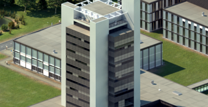
University of Twente
Horst Complex (building no. 20), room W209
De Horst 2
7522 LW Enschede
Netherlands
University of Twente
Horst Complex W209
P.O. Box 217
7500 AE Enschede
Netherlands
 Scan the QR code or